What the geological map tells us
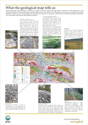
This geological map shows what kind of soil there is at a depth of one meter. Study of the map, however, reveals a lot of other information, as soil information together with altitude data gives an understanding of the terrain of the area. The information on the map can, for example, be used when planning a construction site or going trekking. The map also shows exposed rock, precipices, cobble deposits and additional geological information about such things as groundwater and geological formations.
To continue to read download: ![]()